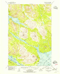
1954 Map of Afognak A-3
USGS Topo · Published 1955About this map
Afognak and the nearby Aleut Village anchor the southern coastline of Afognak Island in this mid-1950s survey. The landscape is defined by the significant waterway of the Afognak River, which drains from Afognak Lake toward the sea. Along this corridor, the map notes a Recreation Camp and a Covered Bridge, indicating the established human presence and infrastructure within the Afognak National Forest.
Find a feature on this map
46 named features on this map. Tap any name to fly to it.
Don’t see what you’re looking for? This feature index may not catch every label — zoom into the map to look around manually.
Map Details
Editions of this 1954 Afognak A-3 Map
This is the sole edition of this map. No revisions or reprints were ever made.
Other maps of this area

1947 · Kodiak D-3
USGS Topo · 1:63,360

1949 · Kodiak D-2
USGS Topo · 1:63,360

1949 · Kodiak D-3
USGS Topo · 1:63,360

1950 · Kodiak D-3
USGS Topo · 1:63,360

1951 · Kodiak D-2
USGS Topo · 1:63,360

1952 · Kodiak
USGS Topo · 1:250,000

1952 · Afognak
USGS Topo · 1:250,000

1952 · Afognak A-4
USGS Topo · 1:63,360

1952 · Afognak A-3
USGS Topo · 1:63,360

1952 · Afognak A-2
USGS Topo · 1:63,360