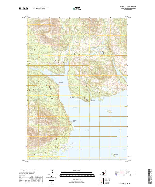
2021 Map of Afognak A-3 SE
USGS Topo · Published 2021About this map
The settlement of Afognak occupies the central western shoreline of Afognak Bay in this coastal Alaskan study. Located on Kodiak Island, the landscape is defined by its deep inlets and complex archipelagos. To the north, the waters of Back Bay are framed by the heights of Hatchery Peak and Last Point, while the southern reaches transition into the Eastern Passage. This survey captures the maritime geography of the region, noting several hazards to navigation such as Danger Reef and Skipwith Reefs. Historical landmarks and landforms are well-documented, including Settlement Point, Graveyard Point, and the prominent rise of Litnik Mtn. The map provides a detailed record of islands like Winter Island and Arnkili Island, which fragment the bay into sheltered coves and narrow channels.
Find a feature on this map
28 named features on this map. Tap any name to fly to it.
Don’t see what you’re looking for? This feature index may not catch every label — zoom into the map to look around manually.
Map Details
Editions of this 2021 Afognak A-3 SE Map
This is the sole edition of this map. No revisions or reprints were ever made.
Other maps of this area

1947 · Kodiak D-3
USGS Topo · 1:63,360

1949 · Kodiak D-2
USGS Topo · 1:63,360

1949 · Kodiak D-3
USGS Topo · 1:63,360

1950 · Kodiak D-3
USGS Topo · 1:63,360

1951 · Kodiak D-2
USGS Topo · 1:63,360

1952 · Kodiak
USGS Topo · 1:250,000

1952 · Afognak
USGS Topo · 1:250,000

1952 · Afognak A-3
USGS Topo · 1:63,360

1952 · Afognak A-2
USGS Topo · 1:63,360
1954 · Afognak A-2
USGS Topo · 1:63,360