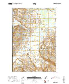
2019 Map of Afognak D-6 NE
USGS Topo · Published 2019About this map
Katmai National Park encompasses the vast majority of this 2019 survey, showcasing a landscape defined by the winding course of the Douglas River. This region on the Alaska Peninsula is characterized by complex hydrography and varying elevations, where the river braids through wide valleys between steep topographic rises. The map details the Public Land Survey System grid, including townships t14s r27w and t15s r27w, which provide essential reference points for this protected wilderness. With no roads or established settlements shown, the document emphasizes the raw natural geography and the intricate drainage patterns that flow toward the coast beyond the sheet's edge. It serves as a precise record of this coastal Alaskan interior, reflecting the preservation of the land within the national park system.
Find a feature on this map
7 named features on this map. Tap any name to fly to it.
Don’t see what you’re looking for? This feature index may not catch every label — zoom into the map to look around manually.
Map Details
Editions of this 2019 Afognak D-6 NE Map
This is the sole edition of this map. No revisions or reprints were ever made.
Other maps of this area

1951 · Iliamna A-3
USGS Topo · 1:63,360

1951 · Iliamna A-1 and A-2
USGS Topo · 1:63,360

1951 · Afognak D-5
USGS Topo · 1:63,360

1951 · Afognak D-6
USGS Topo · 1:63,360

1952 · Iliamna
USGS Topo · 1:250,000

1952 · Afognak
USGS Topo · 1:250,000

1957 · Iliamna
USGS Topo · 1:250,000
1983 · Afognak D-6
USGS Topo · 1:63,360
2018 · Iliamna A-3 SE
USGS Topo · 1:25,000
2018 · Iliamna A-2 SW
USGS Topo · 1:25,000