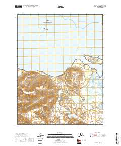
2018 Map of Iliamna A-3 SE
USGS Topo · Published 2018About this map
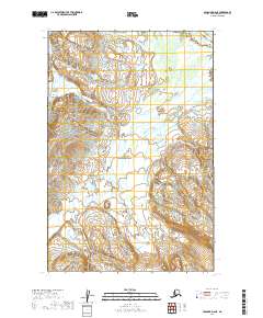
Katmai National Park encompasses the majority of this wilderness landscape on the Kenai Peninsula, where the coastline meets the Pacific Ocean. This 2018 survey illustrates a rugged coastal interface defined by steep topographic contours that drop sharply toward the shoreline. The northern half of the quadrangle is dominated by open water and several small, unnamed coastal islands, while the southern portion features the drainage of the Douglas River as it flows toward the sea. The absence of roads or established settlements highlights the remote character of this protected area, which remains primarily under federal jurisdiction. Researchers can examine the intricate shoreline and the high-elevation ridges that overlook the coast, providing a detailed record of the natural geography within the park boundaries during the early 21st century.
Find a feature on this map
6 named features on this map. Tap any name to fly to it.
Don’t see what you’re looking for? This feature index may not catch every label — zoom into the map to look around manually.
Map Details
Editions of this 2018 Iliamna A-3 SE Map
This is the sole edition of this map. No revisions or reprints were ever made.
Other maps of this area

1951 · Iliamna A-3
USGS Topo · 1:63,360

1951 · Iliamna A-1 and A-2
USGS Topo · 1:63,360

1951 · Afognak D-6
USGS Topo · 1:63,360

1952 · Iliamna
USGS Topo · 1:250,000

1952 · Afognak
USGS Topo · 1:250,000

1957 · Iliamna
USGS Topo · 1:250,000
1983 · Afognak D-6
USGS Topo · 1:63,360
2018 · Iliamna A-2 SW
USGS Topo · 1:25,000
2019 · Afognak D-6 NW
USGS Topo · 1:25,000
2019 · Afognak D-6 NE
USGS Topo · 1:25,000