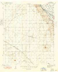
1943 Map of Afton
USGS Topo · Published 1949About this map
The Rio Grande valley and the high Chihuahuan Desert dominate this 1940s landscape, illustrating the contrast between irrigated riverbottoms and the arid uplands of the Mesilla Valley. Along the river’s eastern edge, the land is intricately subdivided into the Mesilla Civil Colony and the Santo Tomas De Yturbide Colony, where a dense network of waterways including the Mesilla Ditch and West Side Canal supported early agricultural efforts.
Find a feature on this map
23 named features on this map. Tap any name to fly to it.
Don’t see what you’re looking for? This feature index may not catch every label — zoom into the map to look around manually.
Map Details
Editions of this 1943 Afton Map
3 editions found

Other maps of this area

1891 · Las Cruces
USGS Topo · 1:125,000

1893 · Las Cruces
USGS Topo · 1:125,000

1917 · Canutillo
USGS Topo · 1:62,500

1917 · Noria
USGS Topo · 1:62,500

1917 · Mt. Riley
USGS Topo · 1:62,500

1918 · Mt. Riley
USGS Topo · 1:62,500

1918 · Noria
USGS Topo · 1:62,500

1919 · Canutillo
USGS Topo · 1:62,500

1929 · Mt. Riley
USGS Topo · 1:62,500

1941 · Las Cruces
USGS Topo · 1:62,500