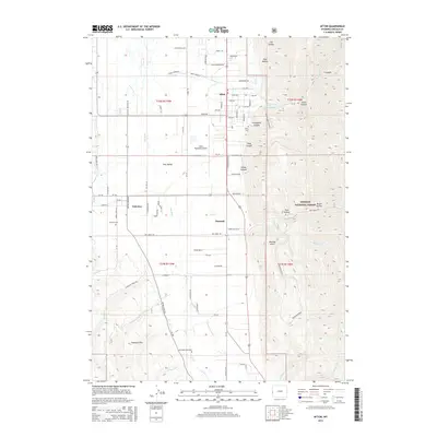
2015 Map of Afton
USGS Topo · Published 2015About this map
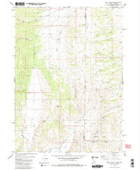
Star Valley provides the setting for this mid-2010s survey, where the Salt River meanders northward through a landscape defined by ranching and small-town settlement. The town of Afton serves as the central hub, joined by the nearby communities of Fairview and Osmond along the valley floor. To the east, the terrain rises sharply into the Bridger National Forest, marked by steep drainages like Graveyard Canyon and Scout Canyon, and notable peaks such as Wickiup Knoll. The map's detailed road network, including family-named routes like Rulen Gardner Ave and Happy Camper Ln, reflects the local character and growth of the region. Genealogists will find value in the precise location of the Afton Cem and Fairview Cem, while the inclusion of the Afton Municipal Airport and irrigation features like Dry Cr and Spring Cr illustrates the intersection of modern infrastructure and traditional western agriculture.
Find a feature on this map
67 named features on this map. Tap any name to fly to it.
Don’t see what you’re looking for? This feature index may not catch every label — zoom into the map to look around manually.
Map Details
Editions of this 2015 Afton Map
This is the sole edition of this map. No revisions or reprints were ever made.
Other maps of this area

1915 · Freedom
USGS Topo · 1:62,500

1915 · Crow Creek
USGS Topo · 1:62,500

1921 · Afton
USGS Topo · 1:125,000

1955 · Preston
USGS Topo · 1:250,000

1958 · Preston
USGS Topo · 1:250,000

1962 · Preston
USGS Topo · 1:250,000
1980 · Grover
USGS Topo · 1:24,000
1980 · Smoot
USGS Topo · 1:24,000
1980 · Elk Valley
USGS Topo · 1:24,000
1980 · Sage Valley
USGS Topo · 1:24,000