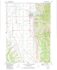
1980 Map of Afton
USGS Topo · Published 1984About this map
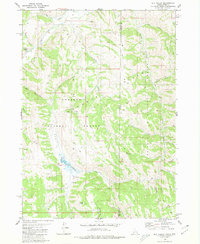
Star Valley dominates this 1980s-era study, where the pastoral agricultural basin meets the steep ascent of the Bridger National Forest. The town of Afton is the primary hub, situated where Swift Creek emerges from the canyons into the valley. This landscape preserves layers of western movement, specifically the Emigrant Salt River Trail and the Lander Cutoff, which skirt the edges of the valley floor. These routes, once vital for mid-19th-century westward migration, remain etched into the topography alongside modern developments like the Municipal Airport and County Fairground. To the west, the Salt River and its accompanying irrigation infrastructure, including the Johnson Ditch, highlight the valley's reliance on water management for ranching. The eastern half shifts abruptly into high-elevation terrain, featuring Swift Creek Lake and numerous named canyons such as Hale Canyon and Elbow Canyon.
Find a feature on this map
39 named features on this map. Tap any name to fly to it.
Don’t see what you’re looking for? This feature index may not catch every label — zoom into the map to look around manually.
Map Details
Editions of this 1980 Afton Map
This is the sole edition of this map. No revisions or reprints were ever made.
Other maps of this area

1915 · Freedom
USGS Topo · 1:62,500
1915 · Crow Creek
USGS Topo · 1:62,500

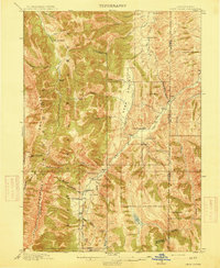
1921 · Afton
USGS Topo · 1:125,000

1955 · Preston
USGS Topo · 1:250,000

1958 · Preston
USGS Topo · 1:250,000

1962 · Preston
USGS Topo · 1:250,000
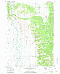
1980 · Grover
USGS Topo · 1:24,000
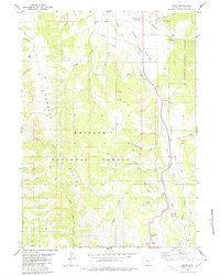
1980 · Smoot
USGS Topo · 1:24,000
1980 · Elk Valley
USGS Topo · 1:24,000
1980 · Sage Valley
USGS Topo · 1:24,000