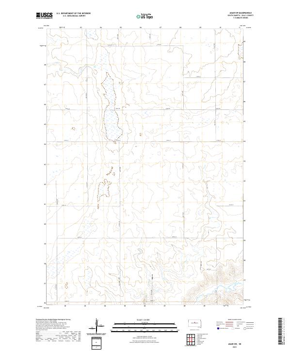
2021 Map of Agar SW
USGS Topo · Published 2021About this map
Okobojo Creek winds through the southeastern corner of this Sully County landscape, defining the local drainage pattern amidst a high-plains grid of section lines and gravel roads. This modern survey reflects the enduring structure of the Public Land Survey System, with township boundaries for t116n r78w and t115n r77w organizing the vast agricultural tracts. The terrain is notably sparse, characterized by a series of ephemeral wetlands and depressions that collect seasonal water in the central and northern reaches of the quadrangle. Transport and movement across this remote section of South Dakota are facilitated by a systematic network of numbered routes, including Agar Rd and 182nd St, which connect dispersed homesteads to the wider region. The map provides a precise contemporary record of the hydrography and topography of the Missouri River plateau area before it descends toward the river valley to the west.
Find a feature on this map
20 named features on this map. Tap any name to fly to it.
Don’t see what you’re looking for? This feature index may not catch every label — zoom into the map to look around manually.
Map Details
Editions of this 2021 Agar SW Map
This is the sole edition of this map. No revisions or reprints were ever made.
Other maps of this area

1954 · Pierre
USGS Topo · 1:250,000

1958 · Pierre
USGS Topo · 1:250,000

1965 · Artichoke Butte
USGS Topo · 1:24,000

1965 · Agar SW
USGS Topo · 1:24,000

1965 · Okobojo NE
USGS Topo · 1:24,000

1965 · Agar
USGS Topo · 1:24,000

1965 · Sully Lake
USGS Topo · 1:24,000

1970 · Agar NW
USGS Topo · 1:24,000
1970 · Agar NE
USGS Topo · 1:24,000
1970 · Artichoke Butte NE
USGS Topo · 1:24,000