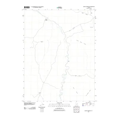
2011 Map of Agency Draw NE
USGS Topo · Published 2011About this map
Willow Creek meanders through this arid landscape of the Uintah Basin, serving as the primary hydrological artery for the region. The map highlights sparse but significant human footprints in this high-desert environment, ranging from the historic Stevens Ranch to the industrial Agency Draw Oil Field. These points of interest are connected by primitive roads and trails that traverse a complex system of drainage basins, including Sunday School Canyon and Buck Canyon.
Find a feature on this map
13 named features on this map. Tap any name to fly to it.
Don’t see what you’re looking for? This feature index may not catch every label — zoom into the map to look around manually.
Map Details
Editions of this 2011 Agency Draw NE Map
This is the sole edition of this map. No revisions or reprints were ever made.
Other maps of this area

1885 · East Tavaputs
USGS Topo · 1:250,000

1956 · Grand Junction
USGS Topo · 1:250,000

1959 · Grand Junction
USGS Topo · 1:250,000

1960 · Grand Junction
USGS Topo · 1:250,000

1962 · Grand Junction
USGS Topo · 1:250,000

1964 · Grand Junction
USGS Topo · 1:250,000

1965 · Grand Junction
USGS Topo · 1:250,000

1966 · Bates Knolls
USGS Topo · 1:24,000
1966 · Agency Draw NE
USGS Topo · 1:24,000
1966 · Wolf Point
USGS Topo · 1:24,000