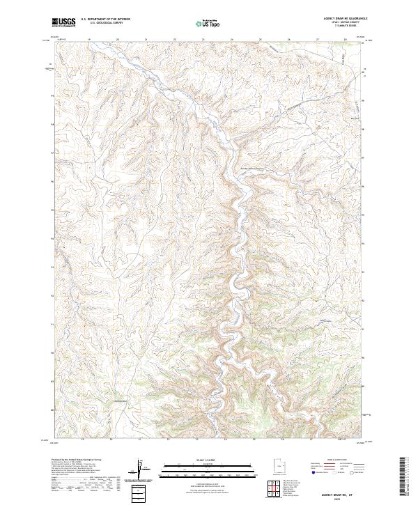
2023 Map of Agency Draw NE
USGS Topo · Published 2023About this map
Willow Creek carves a central path through this high-altitude landscape in Uintah County, Utah, where deep drainages and distinctive rock formations dictate the geography. The terrain is marked by a series of named canyons, including Sunday School Canyon, Buck Canyon, and Wood Canyon, which reveal the complex erosion patterns of the region. Distinctive landmarks like Blue Knoll and Chimney Rock serve as essential navigational points in an area largely defined by its natural features rather than built settlements. Transportation through this part of the Uinta Basin relies on established routes such as Seep Ridge Rd and Willow Creek Rd, which provide access to the ridges and valleys between Flat Rock N and Seep Ridge. The map illustrates a largely unpopulated area where the names often reflect the early experiences of travelers and ranchers, from Jims Reservoir Canyon to the winding Main Canyon.
Find a feature on this map
13 named features on this map. Tap any name to fly to it.
Don’t see what you’re looking for? This feature index may not catch every label — zoom into the map to look around manually.
Map Details
Editions of this 2023 Agency Draw NE Map
This is the sole edition of this map. No revisions or reprints were ever made.
Other maps of this area

1885 · East Tavaputs
USGS Topo · 1:250,000

1956 · Grand Junction
USGS Topo · 1:250,000

1959 · Grand Junction
USGS Topo · 1:250,000

1960 · Grand Junction
USGS Topo · 1:250,000

1962 · Grand Junction
USGS Topo · 1:250,000

1964 · Grand Junction
USGS Topo · 1:250,000

1965 · Grand Junction
USGS Topo · 1:250,000

1966 · Bates Knolls
USGS Topo · 1:24,000
1966 · Agency Draw NE
USGS Topo · 1:24,000
1966 · Wolf Point
USGS Topo · 1:24,000