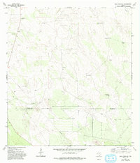
1972 Map of Agua Nueva SE
USGS Topo · Published 1993About this map
Ramirito Ranch sits just north of the county line in this 1970s landscape defined by the livestock and energy industries of Deep South Texas. The map illustrates a distinctive infrastructure of water and extraction, where scattered windmills such as Noria de Llano Windmill, Plato Windmill, and Brazil Windmill are the primary landmarks across the rolling terrain. These named water sources, along with the cluster of buildings at Particion, provide essential points of reference for local historians and genealogists researching the ranching heritage of the area. Industrial activity is concentrated along several corridors, including multiple Oil Well sites and a prominent Pipeline that traverses the southern half of the quadrangle. The boundary between Jim Hogg Co Starr Co cuts across the lower portion of the sheet, marking the transition between these two prominent cattle-raising counties.
Find a feature on this map
16 named features on this map. Tap any name to fly to it.
Don’t see what you’re looking for? This feature index may not catch every label — zoom into the map to look around manually.
Map Details
Editions of this 1972 Agua Nueva SE Map
2 editions found
Other maps of this area

1938 · Agua Nueva
USGS Topo · 1:62,500

1938 · Sal Colorada
USGS Topo · 1:62,500

1939 · La Reforma
USGS Topo · 1:62,500

1939 · Encantada
USGS Topo · 1:62,500

1949 · Mc Allen
USGS Topo · 1:250,000

1954 · McAllen
USGS Topo · 1:250,000

1957 · Mc Allen
USGS Topo · 1:250,000

1962 · McAllen
USGS Topo · 1:250,000
1972 · San Isidro
USGS Topo · 1:24,000
1972 · Santa Elena NW
USGS Topo · 1:24,000