
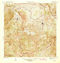
1937 Map of Aguadilla
USGS Topo · Published 1937About this map
Aguadilla sits prominently along the coast of the Bahia De Aguadilla, where the urban center transitions into the agricultural landscape of the 1930s. The region is defined by its coastal infrastructure and burgeoning educational system, marked by numerous rural schoolhouses such as Escuela Borinquen No 227 and Escuela Luis Muñoz Rivera. To the south, the American railroad tracks cut across the landscape toward Coloso, supporting the local sugar industry represented by the Ingenio. This survey reflects an era of transition, where established towns like Aguada are connected by a network of Carretera and Camino routes that navigate between the limestone hills and the fertile valleys of the Rio Culebrinas. Notable landmarks like the Pta Borinquen L H and Columbus Park anchor the shoreline, providing essential maritime and cultural reference points.
Find a feature on this map
37 named features on this map. Tap any name to fly to it.
Don’t see what you’re looking for? This feature index may not catch every label — zoom into the map to look around manually.
Map Details
Editions of this 1937 Aguadilla Map
This is the sole edition of this map. No revisions or reprints were ever made.
Other maps of this area

1937 · Moca
USGS Topo · 1:20,000

1938 · Alto Sano
USGS Topo · 1:20,000

1941 · Moca
USGS Topo · 1:30,000

1941 · Rincon
USGS Topo · 1:30,000

1941 · Rincon
USGS Topo · 1:30,000

1941 · Isabela
USGS Topo · 1:30,000

1942 · Moca
USGS Topo · 1:30,000

1942 · Central La Plata
USGS Topo · 1:30,000

1942 · Aguadilla
USGS Topo · 1:30,000
1946 · Ciales
USGS Topo · 1:30,000