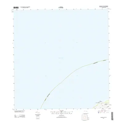
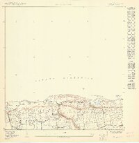
2013 Map of Aguadilla OE N
USGS Topo · Published 2013About this map
Playa Punta Borinquen and the adjacent shoreline of the Island of Puerto Rico mark the southeastern corner of this maritime-focused map, where the land meets the Atlantic Ocean. The geography is defined by prominent coastal points such as Punta Agujereada, which anchors the northwestern edge of the island's visible territory. Inland from these coastal landmarks, a concentrated network of local roads serves the immediate area. Researchers can identify modern infrastructure and access routes such as Cliff Rd, Hook Rd, and Wing Rd. This 2013 survey provides a clear look at the intersection of residential or utility corridors like Calle Belt and San Antonio Rd as they relate to the natural topography of the shoreline before it drops into the open sea.
Find a feature on this map
11 named features on this map. Tap any name to fly to it.
Don’t see what you’re looking for? This feature index may not catch every label — zoom into the map to look around manually.
Map Details
Editions of this 2013 Aguadilla OE N Map
This is the sole edition of this map. No revisions or reprints were ever made.
Other maps of this area

1937 · Aguadilla
USGS Topo · 1:20,000

1937 · Moca
USGS Topo · 1:20,000

1941 · Moca
USGS Topo · 1:30,000

1941 · Isabela
USGS Topo · 1:30,000

1942 · Moca
USGS Topo · 1:30,000

1942 · Aguadilla
USGS Topo · 1:30,000
1950 · Aguadilla NE
USGS Topo · 1:10,000
1950 · Moca NO
USGS Topo · 1:10,000
1950 · Aguadilla NNE
USGS Topo · 1:10,000
1950 · Isabela SO
USGS Topo · 1:10,000