
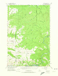
1961 Map of Ahsahka
USGS Topo · Published 1963About this map
The North Fork Clearwater River and the main Clearwater River converge at Ahsahka, anchoring this 1961 survey of Idaho’s Clearwater and Latah counties. This river junction serves as a vital geographic hub, with the Lewis-Clark Canoe Camp State Park marking the historical significance of these waterways. Inland, the high plateaus of the Camas Prairie support a network of small farming and timber communities, including Cavendish, Teakean, and Park.
Find a feature on this map
73 named features on this map. Tap any name to fly to it.
Don’t see what you’re looking for? This feature index may not catch every label — zoom into the map to look around manually.
Map Details
Editions of this 1961 Ahsahka Map
2 editions found
Other maps of this area

1924 · Kamiah
USGS Topo · 1:125,000

1955 · Pullman
USGS Topo · 1:250,000

1958 · Pullman
USGS Topo · 1:250,000

1958 · Culdesac
USGS Topo · 1:62,500

1961 · Deary
USGS Topo · 1:62,500

1961 · Kendrick
USGS Topo · 1:62,500

1961 · Bovill
USGS Topo · 1:62,500

1967 · Peck
USGS Topo · 1:24,000

1967 · Orofino West
USGS Topo · 1:24,000

1967 · Orofino East
USGS Topo · 1:24,000