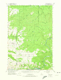
1961 Map of Ahsahka
USGS Topo · Published 1974About this map
Cavendish and Teakean anchor a landscape defined by the convergence of the North Fork and the South Fork of the Clearwater River in north-central Idaho. This 1961 field-checked map illustrates a rural economy reliant on the timber and livestock potential of the surrounding ridges, including Tamarack Ridge and Potlatch Ridge. Evidence of early community infrastructure is preserved through labels for the Teakean-Cavendish School and the United Brethren Camp, alongside various gravel pits and a Quarry indicating local resource extraction. The map also delineates the northern boundary of the Nez Perce Indian Reservation, reflecting the complex historical land divisions of the region. Near the river's bend, the Lewis Clark Canoe Camp State Park and the Beaver Dam Recreation Area highlight the early recognition of this river corridor's historical and recreational significance.
Find a feature on this map
58 named features on this map. Tap any name to fly to it.
Don’t see what you’re looking for? This feature index may not catch every label — zoom into the map to look around manually.
Map Details
Editions of this 1961 Ahsahka Map
2 editions found
Other maps of this area

1924 · Kamiah
USGS Topo · 1:125,000

1955 · Pullman
USGS Topo · 1:250,000

1958 · Pullman
USGS Topo · 1:250,000

1958 · Culdesac
USGS Topo · 1:62,500

1961 · Deary
USGS Topo · 1:62,500

1961 · Kendrick
USGS Topo · 1:62,500

1961 · Ahsahka
USGS Topo · 1:62,500

1961 · Bovill
USGS Topo · 1:62,500

1967 · Peck
USGS Topo · 1:24,000

1967 · Orofino West
USGS Topo · 1:24,000