
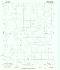
1968 Map of Aiken
USGS Topo · Published 1970About this map
The agrarian landscape along the Hale Co Floyd Co boundary is dominated by the intersecting paths of the Atchison Topeka and Santa Fe and Fort Worth and Denver railroads. These transit lines supported the small communities of Aiken and Lider, serving as essential lifelines for the region’s agricultural output. Evidence of this economic engine is visible in the presence of a Cotton Gin and multiple Storage Bins clustered near the tracks.
Find a feature on this map
20 named features on this map. Tap any name to fly to it.
Don’t see what you’re looking for? This feature index may not catch every label — zoom into the map to look around manually.
Map Details
Editions of this 1968 Aiken Map
This is the sole edition of this map. No revisions or reprints were ever made.
Other maps of this area

1954 · Plainview
USGS Topo · 1:250,000

1958 · Plainview
USGS Topo · 1:250,000

1965 · Silverton SW
USGS Topo · 1:24,000

1965 · Lockney
USGS Topo · 1:24,000

1965 · Plainview
USGS Topo · 1:24,000

1966 · Sterley
USGS Topo · 1:24,000

1968 · Happy Union
USGS Topo · 1:24,000

1968 · Plainview SE
USGS Topo · 1:24,000

1969 · Kress East
USGS Topo · 1:24,000
1969 · Providence
USGS Topo · 1:24,000