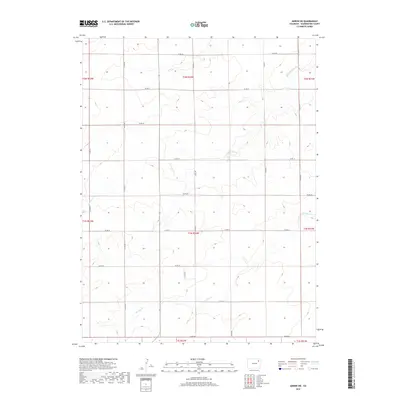
2019 Map of Akron SW
USGS Topo · Published 2019About this map
The drainage basins of Surveyor Cr and Brunker Cr define the topography of this high plains region in Washington County. This survey reflects a classic western section-line grid, where travel and property boundaries are dictates by the cardinal directions of the Public Land Survey System. The map is bisected by numerous rural routes such as Co Rd BB and Co Rd 35, illustrating the systematic division of the land into townships and ranges. This agricultural landscape is punctuated by the subtle relief of the creek beds, which provided vital drainage for the surrounding fields. The lack of concentrated settlements underscores the area's rural character, where the infrastructure is primarily geared toward large-scale farming and ranching operations during the early 21st century.
Find a feature on this map
24 named features on this map. Tap any name to fly to it.
Don’t see what you’re looking for? This feature index may not catch every label — zoom into the map to look around manually.
Map Details
Editions of this 2019 Akron SW Map
This is the sole edition of this map. No revisions or reprints were ever made.
Other maps of this area

1954 · Limon
USGS Topo · 1:250,000

1954 · Sterling
USGS Topo · 1:250,000

1957 · Limon
USGS Topo · 1:250,000

1958 · Limon
USGS Topo · 1:250,000

1958 · Sterling
USGS Topo · 1:250,000

1973 · Antelope Creek East
USGS Topo · 1:24,000

1973 · Akron
USGS Topo · 1:24,000

1973 · Platner
USGS Topo · 1:24,000

1973 · Fremont Butte
USGS Topo · 1:24,000

1973 · Pinneo SE
USGS Topo · 1:24,000