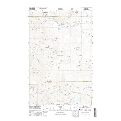
2014 Map of Aladdin Mountain
USGS Topo · Published 2014About this map
Colville National Forest dominates this section of the Selkirk Mountains, where the high-altitude landscape of Stevens and Pend Oreille counties is defined by a dense network of forest service routes and glacial lakes. The topography is anchored by prominent peaks including Aladdin Mtn, Seldom Seen Mtn, and Thomas Mtn. Recreation and resource management are central to the area's identity, evidenced by the concentration of water bodies such as Lake Thomas, Lake Leo, and Big Meadow Lake. Low-lying openings in the timber, labeled as Hills Meadow, Stewart Meadow, and Hande Meadow, provide distinct geographic markers in the heavy forest cover. Along the southern edge, State Hwy 20 provides the primary passage through the terrain, connecting travelers to established sites like the Lake Leo Campground and Princess Pine Camp.
Find a feature on this map
36 named features on this map. Tap any name to fly to it.
Don’t see what you’re looking for? This feature index may not catch every label — zoom into the map to look around manually.
Map Details
Editions of this 2014 Aladdin Mountain Map
This is the sole edition of this map. No revisions or reprints were ever made.
Other maps of this area

1929 · Colville
USGS Topo · 1:125,000

1933 · Colville
USGS Topo · 1:125,000

1934 · Metaline
USGS Topo · 1:125,000

1942 · Metaline
USGS Topo · 1:125,000

1952 · Spirit
USGS Topo · 1:24,000

1952 · Deep Lake
USGS Topo · 1:24,000

1952 · Aladdin
USGS Topo · 1:24,000

1958 · Sandpoint
USGS Topo · 1:250,000

1963 · Sandpoint
USGS Topo · 1:250,000
1966 · Aladdin
USGS Topo · 1:24,000