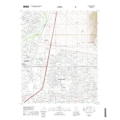
2020 Map of Alameda
USGS Topo · Published 2020About this map
Rio Grande waters define the western geography of this high-desert landscape, where the Corrales Bosque and Upper Corrales Riverside Drain flank the river's edge. The settlement of Corrales occupies the northwestern corner, while the expanding urban footprint of Albuquerque and Los Ranchos de Albuquerque dominates the central and southern reaches. For genealogists, the map is remarkably dense with burial sites, including the Sandoval Cem, Sah Ysidro Cem, and the extensive Sandia Memory Gardens Cem.
Find a feature on this map
345 named features on this map. Tap any name to fly to it.
Don’t see what you’re looking for? This feature index may not catch every label — zoom into the map to look around manually.
Map Details
Editions of this 2020 Alameda Map
This is the sole edition of this map. No revisions or reprints were ever made.
Other maps of this area

1888 · Bernalillo
USGS Topo · 1:125,000

1889 · Albuquerque
USGS Topo · 1:125,000

1892 · San Pedro
USGS Topo · 1:125,000

1893 · Albuquerque
USGS Topo · 1:125,000

1934 · Alameda
USGS Topo · 1:24,000

1934 · West Albuquerque
USGS Topo · 1:24,000

1934 · Griegos
USGS Topo · 1:24,000

1934 · East Albuquerque
USGS Topo · 1:24,000

1938 · Albuquerque
USGS Topo · 1:62,500

1954 · Sandia Crest
USGS Topo · 1:24,000
Featured Places
- Albuquerque, NM
- Corrales, NM
- Los Ranchos de Albuquerque, NM
- Eisenhower Area, Albuquerque
- Academy Ridge East, Albuquerque