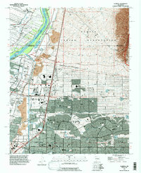
1990 Map of Alameda
USGS Topo · Published 1998About this map
The Rio Grande corridor north of Albuquerque serves as a critical landscape for both ancient heritage and modern recreation. The northern reaches are dominated by the Sandia Indian Reservation and the Pueblo of Sandia, while the river itself is managed through a complex network of irrigation and drainage infrastructure including the Albuquerque Riverside Drain and Corrales Main Canal. Residential expansion is evident in the neighborhoods of Alameda and Ranchitos, stretching toward the foothills of the Cibola National Forest. This era shows a community balancing industry and leisure, with the Reeves Power Plant and various Gravel Pits situated near vast green spaces like Balloon Fiesta Park and the Tanoan Country Club. Cultural and educational landmarks, from the San Carlos Cemetery to the Albuquerque Academy, illustrate the long-term settlement patterns of Bernalillo County.
Find a feature on this map
80 named features on this map. Tap any name to fly to it.
Don’t see what you’re looking for? This feature index may not catch every label — zoom into the map to look around manually.
Map Details
Editions of this 1990 Alameda Map
This is the sole edition of this map. No revisions or reprints were ever made.
Other maps of this area

1888 · Bernalillo
USGS Topo · 1:125,000

1889 · Albuquerque
USGS Topo · 1:125,000

1892 · San Pedro
USGS Topo · 1:125,000

1893 · Albuquerque
USGS Topo · 1:125,000

1934 · Alameda
USGS Topo · 1:24,000

1934 · West Albuquerque
USGS Topo · 1:24,000

1934 · Griegos
USGS Topo · 1:24,000

1934 · East Albuquerque
USGS Topo · 1:24,000

1938 · Albuquerque
USGS Topo · 1:62,500

1954 · Sandia Crest
USGS Topo · 1:24,000
Featured Places
- Albuquerque, NM
- Corrales, NM
- Los Ranchos de Albuquerque, NM
- Prospectors Ridge, Albuquerque
- Academy Ridge East, Albuquerque