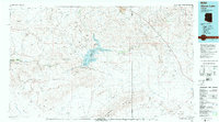
1979 Map of Alamo Lake
USGS Topo · Published 1997About this map
Alamo Lake State Park centers this 1970s landscape, where the confluence of the Big Sandy River and the Santa Maria River forms the Alamo Lake reservoir. This era of the Arizona desert shows a topography defined by heavy mining activity and vast drainage basins. The map captures a complex network of ephemeral washes like Bullard Wash and Cunningham Wash that feed into the Bill Williams River, illustrating the hydraulic connection between the surrounding mountain ranges and the central basin.
Find a feature on this map
34 named features on this map. Tap any name to fly to it.
Don’t see what you’re looking for? This feature index may not catch every label — zoom into the map to look around manually.
Map Details
Editions of this 1979 Alamo Lake Map
2 editions found

Other maps of this area

1887 · Prescott
USGS Topo · 1:250,000

1892 · Prescott
USGS Topo · 1:250,000

1903 · Congress
USGS Topo · 1:125,000

1904 · Congress
USGS Topo · 1:125,000

1911 · Parker
USGS Topo · 1:125,000

1923 · Signal
USGS Topo · 1:250,000

1927 · Buck Mountains
USGS Topo · 1:62,500

1929 · Buck Mountains
USGS Topo · 1:62,500

1930 · Linskey
USGS Topo · 1:62,500

1942 · Signal
USGS Topo · 1:250,000