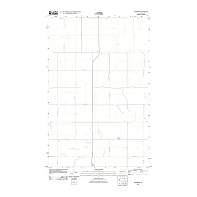
2011 Map of Alamo NE
USGS Topo · Published 2011About this map
The East Opdal Cemetery serves as a primary historical anchor in this section of Williams County, reflecting the deep-rooted agricultural settlement of the North Dakota plains. The landscape is defined by a rigid section-line road grid that has persisted for over a century, including routes such as 92nd St NW and 124th Ave NW. These thoroughfares emphasize the systematic division of land into large farming tracts typical of the region. The presence of County Hwy 14 across the southern reaches indicates the primary corridor for regional transit. While the terrain is characterized by numerous small prairie potholes and intermittent water features, the human imprint is sparse, focusing on a few key sites and the extensive network of numbered roads like 85th St NW and 120th Ave NW.
Find a feature on this map
16 named features on this map. Tap any name to fly to it.
Don’t see what you’re looking for? This feature index may not catch every label — zoom into the map to look around manually.
Map Details
Editions of this 2011 Alamo NE Map
This is the sole edition of this map. No revisions or reprints were ever made.
Other maps of this area

1948 · Alamo N.E.
USGS Topo · 1:24,000

1948 · Crosby SW
USGS Topo · 1:24,000

1948 · Bright Water Lake
USGS Topo · 1:24,000

1948 · Crosby SE
USGS Topo · 1:24,000

1949 · Noonan SW
USGS Topo · 1:24,000

1950 · Crosby
USGS Topo · 1:62,500

1950 · Noonan
USGS Topo · 1:62,500

1953 · Williston
USGS Topo · 1:250,000

1957 · Williston
USGS Topo · 1:250,000

1974 · Wildrose
USGS Topo · 1:24,000