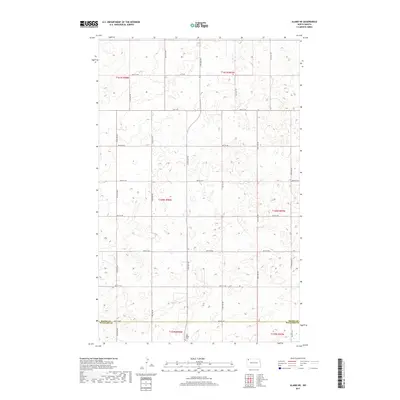
2017 Map of Alamo NE
USGS Topo · Published 2017About this map
The county line between Divide Co and Williams Co bisects this prairie landscape, reflecting the rigid Public Land Survey System that defined North Dakota's agricultural development. The terrain is characterized by numerous small potholes and depressions typical of the Missouri Coteau region, with a network of section-line roads like 90th St NW and 122nd Ave NW providing the only primary infrastructure. A significant point of local interest is the East Opdal Cem, located near the southern border in Township 159 North, Range 98 West. This small burial ground serves as a silent record of the early Scandinavian or European homesteading families who settled these sections. The absence of concentrated townsites emphasizes the dispersed, rural nature of the grain farming and ranching economy that continues to shape this borderland area between the two counties.
Find a feature on this map
26 named features on this map. Tap any name to fly to it.
Don’t see what you’re looking for? This feature index may not catch every label — zoom into the map to look around manually.
Map Details
Editions of this 2017 Alamo NE Map
This is the sole edition of this map. No revisions or reprints were ever made.
Other maps of this area

1948 · Alamo N.E.
USGS Topo · 1:24,000

1948 · Crosby SW
USGS Topo · 1:24,000

1948 · Bright Water Lake
USGS Topo · 1:24,000

1948 · Crosby SE
USGS Topo · 1:24,000

1949 · Noonan SW
USGS Topo · 1:24,000

1950 · Crosby
USGS Topo · 1:62,500

1950 · Noonan
USGS Topo · 1:62,500

1953 · Williston
USGS Topo · 1:250,000

1957 · Williston
USGS Topo · 1:250,000

1974 · Wildrose
USGS Topo · 1:24,000