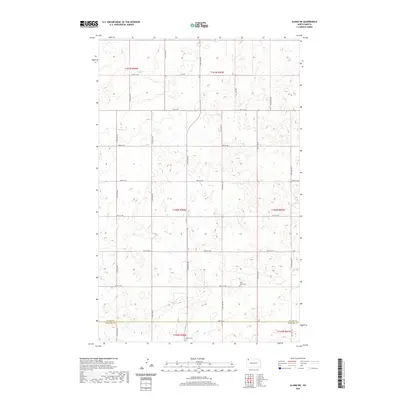
2020 Map of Alamo NE
USGS Topo · Published 2020About this map
East Opdal Cem serves as a quiet landmark within the rural landscape of the Alamo NE quadrangle, a region defined by its vast agricultural grid and the administrative boundary between Divide County and Williams County. This 2020 survey illustrates the meticulous land division of the North Dakota prairies, where section lines are traced by a network of local roads including 90th St NW and 84th St NW. The terrain is characterized by the prairie pothole region's distinctive topography, featuring numerous small depressions and seasonal wetlands. Local history is anchored by sites like Corinth Cem, positioned near the southern edge of the quadrangle. While the area lacks large towns, the map reveals the persistent structure of rural life, where long-standing east-west routes like 87th St NW connect the scattered homesteads and townships of the northern plains.
Find a feature on this map
17 named features on this map. Tap any name to fly to it.
Don’t see what you’re looking for? This feature index may not catch every label — zoom into the map to look around manually.
Map Details
Editions of this 2020 Alamo NE Map
This is the sole edition of this map. No revisions or reprints were ever made.
Other maps of this area

1948 · Alamo N.E.
USGS Topo · 1:24,000

1948 · Crosby SW
USGS Topo · 1:24,000

1948 · Bright Water Lake
USGS Topo · 1:24,000

1948 · Crosby SE
USGS Topo · 1:24,000

1949 · Noonan SW
USGS Topo · 1:24,000

1950 · Crosby
USGS Topo · 1:62,500

1950 · Noonan
USGS Topo · 1:62,500

1953 · Williston
USGS Topo · 1:250,000

1957 · Williston
USGS Topo · 1:250,000

1974 · Wildrose
USGS Topo · 1:24,000