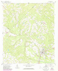
1970 Map of Alamo
USGS Topo · Published 1985About this map
Alamo serves as the focal point of this Wheeler County landscape, situated at the intersection of a regional Pipeline and the Seaboard Coast Line railroad. The map illustrates a rural environment defined by the winding paths of Alligator Creek and Little Creek, where small family and community burial grounds are scattered throughout the countryside. These sites, including Smith Cem, Grimes Cem, and the Little Rock Ch Cem, provide significant genealogical markers for researchers tracing local lineages.
Find a feature on this map
28 named features on this map. Tap any name to fly to it.
Don’t see what you’re looking for? This feature index may not catch every label — zoom into the map to look around manually.
Map Details
Editions of this 1970 Alamo Map
2 editions found
Other maps of this area

1957 · Macon
USGS Topo · 1:250,000

1958 · Macon
USGS Topo · 1:250,000

1964 · Macon
USGS Topo · 1:250,000

1970 · Scotland
USGS Topo · 1:24,000

1970 · Glenwood
USGS Topo · 1:24,000

1970 · Alamo
USGS Topo · 1:24,000

1970 · Jordan
USGS Topo · 1:24,000

1971 · Lothair
USGS Topo · 1:24,000

1972 · Mc Rae NW
USGS Topo · 1:24,000
1972 · Mc Rae
USGS Topo · 1:24,000