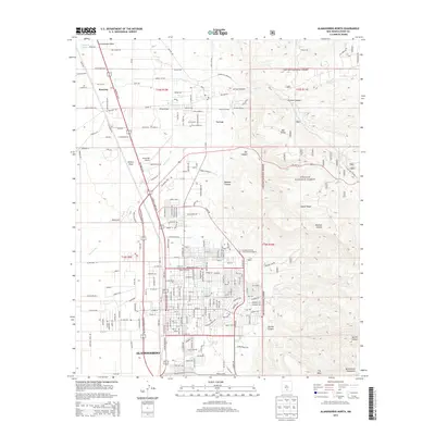
2013 Map of Alamogordo North
USGS Topo · Published 2013About this map
Alamogordo anchors the southwestern portion of this landscape, where the urban grid meets the rising slopes of the Sacramento Mountains. This 2013 survey illustrates the community's northward expansion through developments like Villa Lucia and Villa Christina, while institutional landmarks such as New Mexico State University-Alamogordo mark the transition from city streets to the wilderness of the Lincoln National Forest. To the north, the historic village of La Luz and the settlement at Kearney sit along the corridors of Highway 54 70.
Find a feature on this map
216 named features on this map. Tap any name to fly to it.
Don’t see what you’re looking for? This feature index may not catch every label — zoom into the map to look around manually.
Map Details
Editions of this 2013 Alamogordo North Map
This is the sole edition of this map. No revisions or reprints were ever made.
Other maps of this area
1916 · Tularosa
USGS Topo · 1:125,000
1916 · Point Of Sands
USGS Topo · 1:125,000
1948 · Tularosa
USGS Topo · 1:62,500
1948 · Holloman
USGS Topo · 1:62,500
1950 · Alamogordo
USGS Topo · 1:62,500
1950 · Mescalero
USGS Topo · 1:62,500

1954 · Carlsbad
USGS Topo · 1:250,000
1954 · Tularosa
USGS Topo · 1:250,000
1955 · Las Cruces
USGS Topo · 1:250,000
1955 · Roswell
USGS Topo · 1:250,000