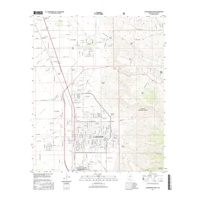
2017 Map of Alamogordo North
USGS Topo · Published 2017About this map
Alamogordo and the historic community of La Luz are situated where the western edge of the Sacramento Mountains meets the high desert floor. This 2017 study details the urban expansion and critical infrastructure serving the region, including the Boles Wells Water System Annex and the New Mexico State University Alamogordo campus. The transition from the structured residential blocks of the city to the steep, arid terrain of Lincoln National Forest is clear, with numerous named canyons like Dry Canyon and Beeman Canyon cutting through the foothills.
Find a feature on this map
148 named features on this map. Tap any name to fly to it.
Don’t see what you’re looking for? This feature index may not catch every label — zoom into the map to look around manually.
Map Details
Editions of this 2017 Alamogordo North Map
This is the sole edition of this map. No revisions or reprints were ever made.
Other maps of this area

1916 · Tularosa
USGS Topo · 1:125,000

1916 · Point Of Sands
USGS Topo · 1:125,000

1948 · Tularosa
USGS Topo · 1:62,500

1948 · Holloman
USGS Topo · 1:62,500

1950 · Alamogordo
USGS Topo · 1:62,500

1950 · Mescalero
USGS Topo · 1:62,500

1954 · Carlsbad
USGS Topo · 1:250,000

1954 · Tularosa
USGS Topo · 1:250,000

1955 · Las Cruces
USGS Topo · 1:250,000

1955 · Roswell
USGS Topo · 1:250,000