
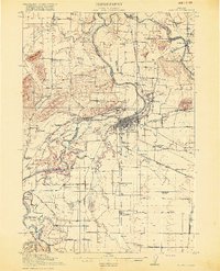
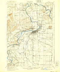
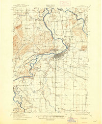
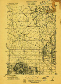
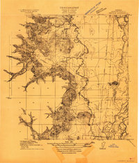
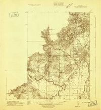
1916 Map of Albany
USGS Topo · Published 1916About this map
The Willamette River and its complex system of sloughs and cutoffs dominate this 1916 landscape, illustrating the intricate relationship between early Oregon agriculture and the waterway. At the heart of the region, Albany serves as a vital junction for the Southern Pacific and Oregon Electric railroads, which weave through the floodplain alongside the Pacific Highway. The survey reveals a landscape of active river management and transit, including the Albany Ditch and multiple river crossings like Fisher Ferry and Williams Ferry.
Find a feature on this map
90 named features on this map. Tap any name to fly to it.
Don’t see what you’re looking for? This feature index may not catch every label — zoom into the map to look around manually.
Map Details
Editions of this 1916 Albany Map
4 editions found
Other maps of this area
1911 · Brownsville
USGS Topo · 1:31,680
1911 · Lebanon
USGS Topo · 1:31,680

1911 · Tangent
USGS Topo · 1:31,680
1911 · Inavale
USGS Topo · 1:31,680

1912 · Jefferson
USGS Topo · 1:31,680

1912 · Halsey
USGS Topo · 1:62,500
1913 · Philomath
USGS Topo · 1:31,680

1913 · Oakville
USGS Topo · 1:31,680

1913 · Wells
USGS Topo · 1:31,680

1914 · Independence
USGS Topo · 1:31,680