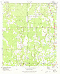
1974 Map of Albany
USGS Topo · Published 1978About this map
The Illinois Central Gulf railroad cuts through the southern reaches of this landscape, connecting the rural communities of Albany and Baptist. The area is defined by a dense network of waterways, including the Natalbany River, Little Natalbany River, and the marshy terrain of Boggy Baygall. This mid-1970s survey highlights the transition from natural drainage to industrial activity, as evidenced by numerous Gravel Pits and Sandpits scattered near the Ponchatoula Creek.
Find a feature on this map
54 named features on this map. Tap any name to fly to it.
Don’t see what you’re looking for? This feature index may not catch every label — zoom into the map to look around manually.
Map Details
Editions of this 1974 Albany Map
This is the sole edition of this map. No revisions or reprints were ever made.
Other maps of this area

1934 · Springfield
USGS Topo · 1:62,500

1935 · Ponchatoula
USGS Topo · 1:62,500

1939 · Ponchatoula
USGS Topo · 1:62,500

1939 · Springfield
USGS Topo · 1:62,500

1940 · Tickfaw
USGS Topo · 1:31,680

1942 · Montpelier
USGS Topo · 1:31,680

1942 · Loranger
USGS Topo · 1:31,680

1949 · Amite
USGS Topo · 1:31,680

1949 · Albany
USGS Topo · 1:31,680

1950 · Doyle
USGS Topo · 1:31,680