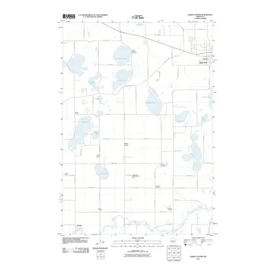
2010 Map of Albion Center
USGS Topo · Published 2010About this map
The North Fork Crow River winds across the southern reaches of this Wright County landscape, defining the topography south of the numerous glacial basins that dot the region. The settlement of Maple Lake anchors the northeastern corner, where the Maple Lake Post Office serves the local community. Further south, the small inland crossroads of Albion Center and Albright provide focal points for the surrounding agricultural district. The area is notable for its high density of rural burial grounds, including Sylvan Cemetery, Highland Cemetery, and the Alamaa Cemetery, which offer valuable data for family history researchers. Unusual aviation infrastructure appears at the Centerville Lake Seaplane Base on the shores of Camp Lake, while the Swart Watts Lake Dam regulates water levels near the northern boundary. Dozens of named lakes, such as Granite Lake and Henshaw Lake, illustrate the water-rich character of the Minnesota interior.
Find a feature on this map
64 named features on this map. Tap any name to fly to it.
Don’t see what you’re looking for? This feature index may not catch every label — zoom into the map to look around manually.
Map Details
Editions of this 2010 Albion Center Map
This is the sole edition of this map. No revisions or reprints were ever made.
Other maps of this area

1951 · Annandale
USGS Topo · 1:62,500

1953 · Saint Cloud
USGS Topo · 1:250,000

1953 · Stillwater
USGS Topo · 1:250,000

1955 · Stillwater
USGS Topo · 1:250,000

1957 · Saint Cloud
USGS Topo · 1:250,000

1958 · Stillwater
USGS Topo · 1:250,000

1958 · Saint Cloud
USGS Topo · 1:250,000

1958 · Buffalo
USGS Topo · 1:62,500

1958 · Cokato
USGS Topo · 1:62,500

1961 · Silver Creek
USGS Topo · 1:24,000
Featured Places
- Maple Lake, MN
- Albright, MN
- Maple Lake Mobile Home Park, Maple Lake
- Corinna Township, MN
- Maple Lake Township, MN