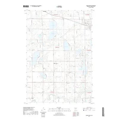
2019 Map of Albion Center
USGS Topo · Published 2019About this map
Albion Center and the surrounding agricultural lands of Wright County are defined by a complex network of glacial basins and water bodies. This landscape is punctuated by numerous rural cemeteries, including Mount Herman Cem and Bethlehem Cem, which provide essential touchstones for genealogical research in this part of Minnesota. The topography is dominated by large lakes such as Swartout Lake, Albion Lake, and Granite Lake, while the southern portion of the quadrangle is shaped by the meandering course of the North Fork Crow River. The map illustrates the transition from the lakeside settlements of Annandale and Maple Lake in the north to the quieter hamlet of Albright in the south, linked by a grid of county roads that navigate around the numerous wetlands and sloughs.
Find a feature on this map
56 named features on this map. Tap any name to fly to it.
Don’t see what you’re looking for? This feature index may not catch every label — zoom into the map to look around manually.
Map Details
Editions of this 2019 Albion Center Map
This is the sole edition of this map. No revisions or reprints were ever made.
Other maps of this area

1951 · Annandale
USGS Topo · 1:62,500

1953 · Saint Cloud
USGS Topo · 1:250,000

1953 · Stillwater
USGS Topo · 1:250,000

1955 · Stillwater
USGS Topo · 1:250,000

1957 · Saint Cloud
USGS Topo · 1:250,000

1958 · Stillwater
USGS Topo · 1:250,000

1958 · Saint Cloud
USGS Topo · 1:250,000

1958 · Buffalo
USGS Topo · 1:62,500

1958 · Cokato
USGS Topo · 1:62,500

1961 · Silver Creek
USGS Topo · 1:24,000
Featured Places
- Maple Lake, MN
- Albright, MN
- Maple Lake Mobile Home Park, Maple Lake
- Corinna Township, MN
- Maple Lake Township, MN