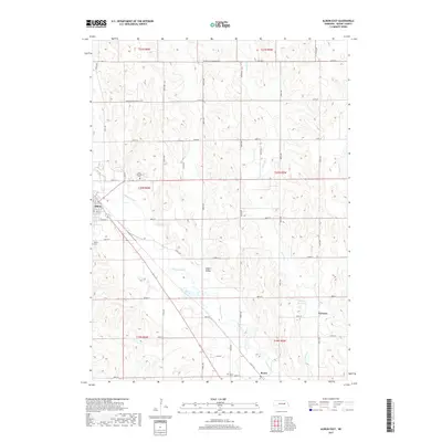
2017 Map of Albion East
USGS Topo · Published 2017About this map
Beaver Creek meanders through the heart of the eastern Boone County landscape, carving a fertile corridor between the rolling uplands and the O'Neil Valley. This agricultural region is defined by a rigorous section-line road network, where the eastern edge of Albion transitions into a series of rural settlements and cemeteries. Local history is anchored at sites like Saint Michael Cem and the Boone Cem, reflecting the generations that have worked this land. Small community hubs such as Boone and Vorhees are documented alongside water management features like Choat Reservoir, which together illustrate the 21st-century irrigation and settlement patterns of central Nebraska. The drainage of Vorhees Cr further emphasizes the topographic variation that has shaped the area's development from its ranching roots to contemporary farming.
Find a feature on this map
32 named features on this map. Tap any name to fly to it.
Don’t see what you’re looking for? This feature index may not catch every label — zoom into the map to look around manually.
Map Details
Editions of this 2017 Albion East Map
This is the sole edition of this map. No revisions or reprints were ever made.
Other maps of this area

1954 · Albion West
USGS Topo · 1:24,000

1954 · Cedar Rapids SE
USGS Topo · 1:24,000

1955 · Broken Bow
USGS Topo · 1:250,000

1955 · Fremont
USGS Topo · 1:250,000

1956 · Broken Bow
USGS Topo · 1:250,000

1957 · Fremont
USGS Topo · 1:250,000

1958 · Fremont
USGS Topo · 1:250,000

1958 · St. Edward
USGS Topo · 1:24,000

1958 · Albion East
USGS Topo · 1:24,000
1958 · St. Edward SW
USGS Topo · 1:24,000