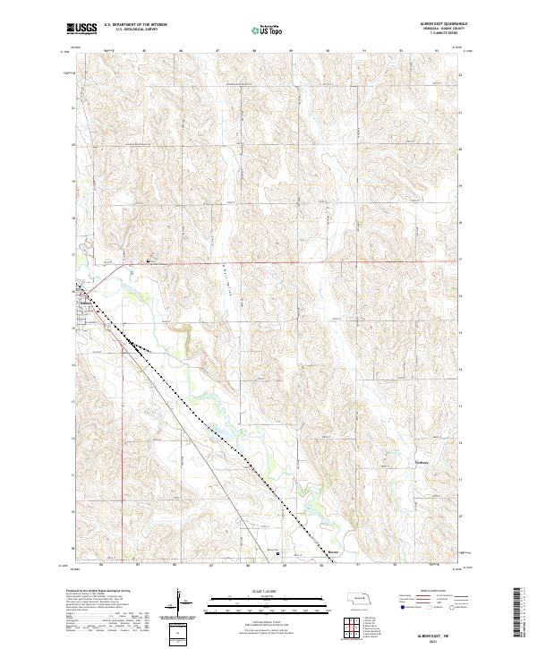
2021 Map of Albion East
USGS Topo · Published 2021About this map
Albion lies at the western edge of this 2021 survey, where the prairie landscape of Boone County is carved by the meandering path of Beaver Creek. The terrain is defined by the broad O'Neill Valley and a series of north-south ridges that separate drainage systems like Vorhees Cr. This map documents a contemporary rural layout where section-line roads, such as 240th ST and 270th ST, create a precise grid over the rolling loess hills. Local heritage is anchored by significant sites like Saint Michael Cem and the Boone Cem, located near the small settlement of Boone in the southern portion of the quadrangle. The presence of Choat Reservoir and several named watercourses highlights the importance of water management in this agricultural region, while various minimum maintenance roads suggest the persistent, rural character of the Nebraska countryside.
Find a feature on this map
29 named features on this map. Tap any name to fly to it.
Don’t see what you’re looking for? This feature index may not catch every label — zoom into the map to look around manually.
Map Details
Editions of this 2021 Albion East Map
This is the sole edition of this map. No revisions or reprints were ever made.
Other maps of this area

1954 · Albion West
USGS Topo · 1:24,000

1954 · Cedar Rapids SE
USGS Topo · 1:24,000

1955 · Broken Bow
USGS Topo · 1:250,000

1955 · Fremont
USGS Topo · 1:250,000

1956 · Broken Bow
USGS Topo · 1:250,000

1957 · Fremont
USGS Topo · 1:250,000

1958 · Fremont
USGS Topo · 1:250,000

1958 · St. Edward
USGS Topo · 1:24,000

1958 · Albion East
USGS Topo · 1:24,000
1958 · St. Edward SW
USGS Topo · 1:24,000