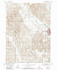
1954 Map of Albion West
USGS Topo · Published 1985About this map
Albion serves as the focal point of this mid-century landscape, positioned where the hills meet the valley of Beaver Creek. The town's layout is well-documented, showing the central Courthouse, City Hall, and Hospital alongside local institutions like the High Sch and Albion Cem. Outside the residential core, the map captures a period of civic infrastructure including the Fairground, the Country Club, and the Albion Muni Airport to the northwest.
Find a feature on this map
14 named features on this map. Tap any name to fly to it.
Don’t see what you’re looking for? This feature index may not catch every label — zoom into the map to look around manually.
Map Details
Editions of this 1954 Albion West Map
2 editions found
Other maps of this area

1954 · Cedar Rapids
USGS Topo · 1:24,000

1954 · Akron
USGS Topo · 1:24,000

1954 · Albion West
USGS Topo · 1:24,000

1954 · Cedar Rapids SE
USGS Topo · 1:24,000

1955 · Broken Bow
USGS Topo · 1:250,000

1955 · Fremont
USGS Topo · 1:250,000

1956 · Broken Bow
USGS Topo · 1:250,000

1957 · Fremont
USGS Topo · 1:250,000

1958 · Fremont
USGS Topo · 1:250,000

1958 · Albion East
USGS Topo · 1:24,000