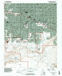
1990 Map of Albuquerque East
USGS Topo · Published 1996About this map
Albuquerque expansion defines this 1990s landscape, illustrating the dense suburban growth and military-institutional footprints in Bernalillo County. The map provides a detailed view of the University of New Mexico campus and the sprawling State Fairground, including landmarks like Tingley Coliseum. The southern half is dominated by Kirtland Air Force Base and Sandia Base, reflecting the area's Cold War era importance.
Find a feature on this map
69 named features on this map. Tap any name to fly to it.
Don’t see what you’re looking for? This feature index may not catch every label — zoom into the map to look around manually.
Map Details
Editions of this 1990 Albuquerque East Map
This is the sole edition of this map. No revisions or reprints were ever made.
Other maps of this area

1888 · Bernalillo
USGS Topo · 1:125,000

1889 · Albuquerque
USGS Topo · 1:125,000

1892 · San Pedro
USGS Topo · 1:125,000

1893 · Albuquerque
USGS Topo · 1:125,000

1917 · Estancia
USGS Topo · 1:125,000

1934 · Alameda
USGS Topo · 1:24,000

1934 · West Albuquerque
USGS Topo · 1:24,000

1934 · Griegos
USGS Topo · 1:24,000

1934 · East Albuquerque
USGS Topo · 1:24,000

1938 · Albuquerque
USGS Topo · 1:62,500
Featured Places
- Albuquerque, NM
- Oñate, Albuquerque
- La Mesa, Albuquerque
- Juan Tabo Hills, Albuquerque
- Manzano Manor, Albuquerque