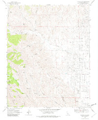
1969 Map of Alcalde Hills
USGS Topo · Published 1982About this map
The Alcalde Hills and Juniper Ridge define a landscape shaped by petroleum extraction and drainage during the late 1960s. This survey reveals a dense network of industrial infrastructure throughout the Oil Field on the eastern edge of the quadrangle, where numerous drill holes and oil sumps are connected by a grid of named routes like Tornado Avenue and Gale Avenue. The transition from the high, arid ridges of the Diablo Range down into the Coalinga Valley and Pleasant Valley is marked by isolated landmarks such as Sprague Cabin and Dodge Mill. These features, along with scattered water sources like Indian Springs and Salt Spring, suggest a history of seasonal ranching and prospecting that predates and eventually coexisted with the more intensive energy development of the 20th century. Major drainages including Los Gatos Creek and Coalmine Canyon cut deep into the hills, providing natural corridors for early roads and trails.
Find a feature on this map
48 named features on this map. Tap any name to fly to it.
Don’t see what you’re looking for? This feature index may not catch every label — zoom into the map to look around manually.
Map Details
Editions of this 1969 Alcalde Hills Map
3 editions found
Other maps of this area

1912 · Coalinga
USGS Topo · 1:125,000

1915 · Priest Valley
USGS Topo · 1:125,000

1936 · Kreyenhagen Hills
USGS Topo · 1:31,680
1941 · Kreyenhagen Hills
USGS Topo · 1:31,680

1941 · Priest Valley
USGS Topo · 1:62,500

1943 · New Idria
USGS Topo · 1:62,500

1943 · Joaquin Rocks
USGS Topo · 1:62,500
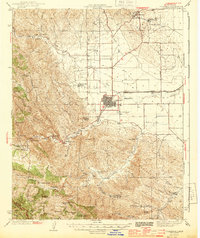
1944 · Coalinga
USGS Topo · 1:62,500

1944 · Priest Valley
USGS Topo · 1:62,500

1948 · Santa Cruz
USGS Topo · 1:250,000