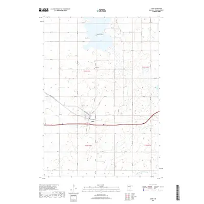
2019 Map of Alden
USGS Topo · Published 2019About this map
Alden anchors this southern Minnesota landscape, positioned as a hub for local transit and agriculture just north of the county line. The town's grid is centered near Morin Lake, while the surrounding prairie is defined by a complex network of waterways and drainage systems, including the Cobb River and Steward Cr. To the north, Freeborn Lake features distinctive landforms like Chicks Point and Arrowhead Point, which break up the wetland-heavy terrain.
Find a feature on this map
40 named features on this map. Tap any name to fly to it.
Don’t see what you’re looking for? This feature index may not catch every label — zoom into the map to look around manually.
Map Details
Editions of this 2019 Alden Map
This is the sole edition of this map. No revisions or reprints were ever made.
Other maps of this area

1954 · Albert Lea
USGS Topo · 1:62,500

1954 · Mason City
USGS Topo · 1:250,000

1955 · Wells
USGS Topo · 1:62,500

1957 · Mason City
USGS Topo · 1:250,000

1958 · Mason City
USGS Topo · 1:250,000

1967 · Freeborn
USGS Topo · 1:24,000
1967 · Matawan
USGS Topo · 1:24,000

1967 · Hartland
USGS Topo · 1:24,000

1982 · Albert Lea West
USGS Topo · 1:24,000
1982 · Emmons
USGS Topo · 1:24,000