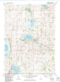
1982 Map of Emmons
USGS Topo · Published 1983About this map
The settlement of Emmons sits at the very base of the Minnesota border in the early 1980s, adjacent to State Line Lake and the Freeborn and Worth County boundary. This agricultural landscape in Nunda and Freeman townships is defined by its glaciated hydrology, where an extensive network of drainage projects like County Ditch No 4 and Judicial Ditch No 9 lace between numerous lakes. To the north, the village of Twin Lakes is positioned near an Old RR Grade, suggesting the area's older transportation corridor. Local history is anchored by several rural landmarks including Shady Oak Church and Lunder Church Cemetery, while conservation areas such as the Bear Lake State Wildlife Area and White Woods County Park preserve the natural character of the Lower Twin Lake and Bear Lake shorelines.
Find a feature on this map
39 named features on this map. Tap any name to fly to it.
Don’t see what you’re looking for? This feature index may not catch every label — zoom into the map to look around manually.
Map Details
Editions of this 1982 Emmons Map
This is the sole edition of this map. No revisions or reprints were ever made.
Other maps of this area

1954 · Albert Lea
USGS Topo · 1:62,500

1954 · Mason City
USGS Topo · 1:250,000

1955 · Wells
USGS Topo · 1:62,500

1957 · Mason City
USGS Topo · 1:250,000

1958 · Mason City
USGS Topo · 1:250,000

1972 · Fertile NE
USGS Topo · 1:24,000

1972 · Bristol
USGS Topo · 1:24,000
1972 · Lake Mills
USGS Topo · 1:24,000

1982 · Albert Lea West
USGS Topo · 1:24,000
1982 · Alden
USGS Topo · 1:24,000
Featured Places
- Emmons, MN
- Twin Lakes, MN
- Emmons Trailer Court, Emmons
- Lakeview Mobile Home Park, Twin Lakes
- Freeborn County, MN