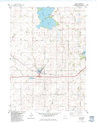
1982 Map of Alden
USGS Topo · Published 1983About this map
Alden sits as the central hub of this Southern Minnesota landscape, where the Chicago Milwaukee St Paul and Pacific railroad tracks bisect the town near Morin Lake. The surrounding prairie is defined by its water and conservation efforts, including the broad Freeborn Lake to the north and Pickerel Lake to the southeast. Local history is etched into the township grids of Carlston and Manchester, featuring the Carlston Cem and a smaller Cem near the village. Transportation shifts are visible through the presence of an Old Railroad Grade north of town, reflecting a changing rail economy. Recreational and natural spaces are prominent, from the Arrowhead Point County Park on the shores of Freeborn Lake to the Halls Lake State Wildlife Area, indicating a region that balances agricultural use with environmental preservation.
Find a feature on this map
25 named features on this map. Tap any name to fly to it.
Don’t see what you’re looking for? This feature index may not catch every label — zoom into the map to look around manually.
Map Details
Editions of this 1982 Alden Map
This is the sole edition of this map. No revisions or reprints were ever made.
Other maps of this area

1954 · Albert Lea
USGS Topo · 1:62,500

1954 · Mason City
USGS Topo · 1:250,000

1955 · Wells
USGS Topo · 1:62,500

1957 · Mason City
USGS Topo · 1:250,000

1958 · Mason City
USGS Topo · 1:250,000

1967 · Freeborn
USGS Topo · 1:24,000
1967 · Matawan
USGS Topo · 1:24,000

1967 · Hartland
USGS Topo · 1:24,000

1982 · Albert Lea West
USGS Topo · 1:24,000
1982 · Emmons
USGS Topo · 1:24,000