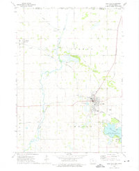
1972 Map of Lake Mills
USGS Topo · Published 1975About this map
Lake Mills serves as a significant hub for the surrounding agricultural landscape of northern Winnebago Co, Iowa, near the border with Minnesota. This 1972 survey captures a transition in the local economy, where the Chicago and North Western railroad bisects the town, connecting it to the broader industrial network. The map reveals a high concentration of community landmarks, including the Salem Cem and Sunnyside Cem, alongside smaller settlements like Scarville.
Find a feature on this map
37 named features on this map. Tap any name to fly to it.
Don’t see what you’re looking for? This feature index may not catch every label — zoom into the map to look around manually.
Map Details
Editions of this 1972 Lake Mills Map
This is the sole edition of this map. No revisions or reprints were ever made.
Other maps of this area

1954 · Albert Lea
USGS Topo · 1:62,500

1954 · Mason City
USGS Topo · 1:250,000

1955 · Wells
USGS Topo · 1:62,500

1957 · Mason City
USGS Topo · 1:250,000

1958 · Mason City
USGS Topo · 1:250,000

1972 · Forest City
USGS Topo · 1:24,000

1972 · Fertile
USGS Topo · 1:24,000

1972 · Bristol
USGS Topo · 1:24,000

1972 · Pilot Knob
USGS Topo · 1:24,000

1972 · Vinje
USGS Topo · 1:24,000