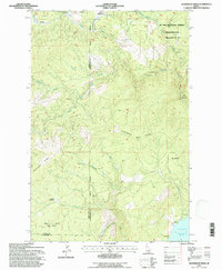
1994 Map of Aldermand Ridge
USGS Topo · Published 1997About this map
St Joe National Forest dominates this mountain landscape, which was revised in the mid-1990s based on data spanning back several decades. The terrain is defined by prominent elevations like Aldermand Ridge and Norwegian Ridge, which overlook a network of drainages including Three Bear Creek and Long Meadow Creek. Human presence is largely tied to forest management and recreation, evidenced by the Mason Lookout atop Mason Butte and several Campsites along the shoreline.
Find a feature on this map
34 named features on this map. Tap any name to fly to it.
Don’t see what you’re looking for? This feature index may not catch every label — zoom into the map to look around manually.
Map Details
Editions of this 1994 Aldermand Ridge Map
This is the sole edition of this map. No revisions or reprints were ever made.
Other maps of this area

1955 · Pullman
USGS Topo · 1:250,000

1958 · Pullman
USGS Topo · 1:250,000

1961 · Ahsahka
USGS Topo · 1:62,500

1961 · Bovill
USGS Topo · 1:62,500

1969 · Elk River
USGS Topo · 1:24,000

1969 · Elk Creek Falls
USGS Topo · 1:24,000
1969 · Dent
USGS Topo · 1:24,000

1981 · Potlatch
USGS Topo · 1:100,000
1990 · Ahsahka
USGS Topo · 1:24,000
1990 · Mc Gary Butte
USGS Topo · 1:24,000