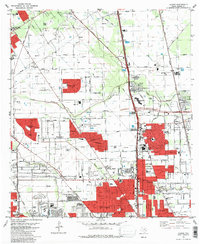
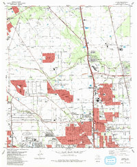
1982 Map of Aldine
USGS Topo · Published 1983About this map
Houston National Cemetery and Paradise Cemetery anchor the northern reaches of the Houston metropolitan area as it expanded rapidly during the early 1980s. This survey illustrates the transformation of rural Harris County acreage into dense residential developments like Rushwood, Woodgate, and Fallbrook. The landscape is a complex intersection of petroleum infrastructure, seen in the sprawling Oil And Gas Field near Bammel, and modern commercial centers like the Greenspoint Mall.
Find a feature on this map
65 named features on this map. Tap any name to fly to it.
Don’t see what you’re looking for? This feature index may not catch every label — zoom into the map to look around manually.
Map Details
Editions of this 1982 Aldine Map
2 editions found
Other maps of this area

1915 · Houston Heights
USGS Topo · 1:24,000

1915 · Hillendahl
USGS Topo · 1:24,000

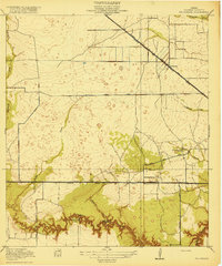
1916 · Aldine
USGS Topo · 1:24,000

1916 · Settegast
USGS Topo · 1:24,000

1916 · Louetta
USGS Topo · 1:24,000

1916 · Satsuma
USGS Topo · 1:24,000

1916 · Humble
USGS Topo · 1:24,000

1916 · Spring
USGS Topo · 1:24,000
1918 · Hillendahl
USGS Topo · 1:31,680
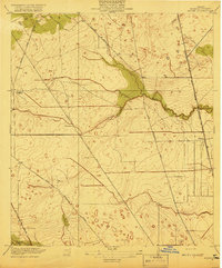
1919 · Aldine
USGS Topo · 1:31,680