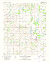
1981 Map of Alex
USGS Topo · Published 1982About this map
The Washita River and its major tributary, the Little Washita River, dominate this central Oklahoma landscape near the beginning of the 1980s. The settlement of Alex serves as a local hub, situated at the intersection of several roads and adjacent to the river bottomlands. Further north and west, the smaller communities of Lucile and Naples are mapped alongside rural landmarks like Hawkins Ch. Evidence of the area's changing infrastructure is visible in the Old Railroad Grade cutting across the northern sections, while the presence of several Oil Wells and a Sewage Disp Ponds facility reflect the modern utility and industrial footprint of the era. Genealogists may find value in the specific locations of Ireton Cem and the Alex Cem positioned on the outskirts of their respective townships.
Find a feature on this map
20 named features on this map. Tap any name to fly to it.
Don’t see what you’re looking for? This feature index may not catch every label — zoom into the map to look around manually.
Map Details
Editions of this 1981 Alex Map
This is the sole edition of this map. No revisions or reprints were ever made.
Other maps of this area

1902 · Rush Springs
USGS Topo · 1:125,000

1904 · Chickasha
USGS Topo · 1:125,000

1949 · Rush Springs
USGS Topo · 1:62,500

1950 · Rush Springs
USGS Topo · 1:62,500

1954 · Oklahoma City
USGS Topo · 1:250,000

1957 · Ardmore
USGS Topo · 1:250,000

1957 · Oklahoma City
USGS Topo · 1:250,000

1963 · Ardmore
USGS Topo · 1:250,000

1963 · Oklahoma City
USGS Topo · 1:250,000
1965 · Dibble
USGS Topo · 1:24,000