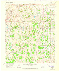
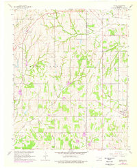
1965 Map of Dibble
USGS Topo · Published 1966About this map
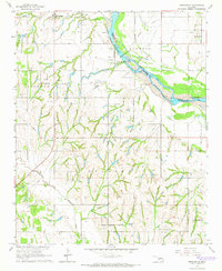
Walnut Creek and its many tributaries, including Buffalo Creek and Spring Creek, define the landscape of the Oklahoma prairie across the Grady and McClain county line. This mid-1960s survey documents the agricultural and industrial character of the region, anchored by the settlements of Middleberg in the northwest and Dibble in the southeast. A network of rural section-line roads connects established community centers like Central Ch and Dibble Ch, alongside family landmarks such as Hale Cem and Naples Cem.
Find a feature on this map
27 named features on this map. Tap any name to fly to it.
Don’t see what you’re looking for? This feature index may not catch every label — zoom into the map to look around manually.
Map Details
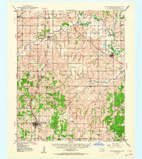
Editions of this 1965 Dibble Map
2 editions found
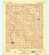
Other maps of this area

1902 · Rush Springs
USGS Topo · 1:125,000

1904 · Chickasha
USGS Topo · 1:125,000
1949 · Rush Springs
USGS Topo · 1:62,500
1950 · Rush Springs
USGS Topo · 1:62,500

1954 · Oklahoma City
USGS Topo · 1:250,000

1957 · Ardmore
USGS Topo · 1:250,000

1957 · Oklahoma City
USGS Topo · 1:250,000

1963 · Ardmore
USGS Topo · 1:250,000

1963 · Oklahoma City
USGS Topo · 1:250,000
1965 · Newcastle
USGS Topo · 1:24,000