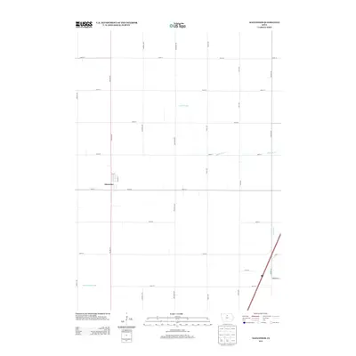
2013 Map of Alexander
USGS Topo · Published 2013About this map
Alexander sits at the heart of this agricultural landscape in Franklin County, where a rigid grid of rural roads defines the movement of modern commerce and farming. The town is concentrated primarily between 4th St and 190th St, anchored by Balsam Ave. Outside the town center, the terrain is shaped by the subtle drainage patterns of Buffalo Creek and the southern reaches of Spring Creek, alongside human-engineered water management features like Ditch Number 146. This 2013 survey illustrates the high-precision grid system common to the region, with north-south thoroughfares such as Dogwood Ave and Eagle Ave intersecting perfectly spaced east-west roads. The map captures the interface between the small-town residential layout of Alexander and the vast, systematically organized Iowa countryside that surrounds it.
Find a feature on this map
24 named features on this map. Tap any name to fly to it.
Don’t see what you’re looking for? This feature index may not catch every label — zoom into the map to look around manually.
Map Details
Editions of this 2013 Alexander Map
This is the sole edition of this map. No revisions or reprints were ever made.
Other maps of this area

1954 · Waterloo
USGS Topo · 1:250,000

1955 · Waterloo
USGS Topo · 1:250,000

1972 · Alexander
USGS Topo · 1:24,000

1972 · Thornton
USGS Topo · 1:24,000

1972 · Swaledale
USGS Topo · 1:24,000

1972 · Belmond
USGS Topo · 1:24,000

1972 · Latimer
USGS Topo · 1:24,000
1972 · Goodell
USGS Topo · 1:24,000

1978 · Dows West
USGS Topo · 1:24,000

1979 · Dows East
USGS Topo · 1:24,000