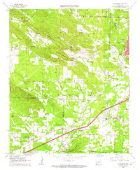
1961 Map of Alexander
USGS Topo · Published 1962About this map
Ellis Mountain and the prominent Big Rock formation anchor this 1961 survey of the landscape southwest of Little Rock. The area is defined by a dense network of watercourses including Fourche Creek, Brodie Creek, and McHenry Creek, which carve through the terrain near early settlements like Martindale and Collegeville. Evidence of local industry and infrastructure is visible in the several quarries and the presence of the Garretts Landing Strip.
Find a feature on this map
63 named features on this map. Tap any name to fly to it.
Don’t see what you’re looking for? This feature index may not catch every label — zoom into the map to look around manually.
Map Details
Editions of this 1961 Alexander Map
4 editions found
Other maps of this area

1890 · Benton
USGS Topo · 1:125,000

1891 · Little Rock
USGS Topo · 1:125,000

1893 · Little Rock
USGS Topo · 1:125,000

1894 · Benton
USGS Topo · 1:125,000

1935 · Little Rock
USGS Topo · 1:24,000

1935 · North Little Rock
USGS Topo · 1:24,000

1935 · Alexander
USGS Topo · 1:48,000

1938 · Benton
USGS Topo · 1:48,000

1941 · Alexander
USGS Topo · 1:62,500

1943 · Pinnacle Mtn
USGS Topo · 1:31,680