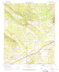
1961 Map of Alexander
USGS Topo · Published 1971About this map
Ellis Mountain and the Big Rock Valley dominate this landscape southwest of Little Rock, where the rural fringe of Pulaski and Saline counties transitioned into suburban development during the early 1960s. The topographic detail captures a network of small settlements and institutions, from Alexander and Collegeville in the south to the State Girls Training Sch near the western edge. Cultural landmarks like the Benton Speed Bowl and the Garretts Landing Strip reflect the era's local recreation and transportation, while the Missouri Pacific corridor anchors the economic geography of the valley. Genealogists and local historians can locate numerous family-named burial grounds and rural congregations, including Ida Mission Cem, Crystal Hill Ch & Cem, and Quinn Chapel. The map also documents the significant presence of large memorial grounds like Forest Hills Memorial Park and Pinecrest Memorial Park.
Find a feature on this map
64 named features on this map. Tap any name to fly to it.
Don’t see what you’re looking for? This feature index may not catch every label — zoom into the map to look around manually.
Map Details
Editions of this 1961 Alexander Map
4 editions found
Other maps of this area

1890 · Benton
USGS Topo · 1:125,000

1891 · Little Rock
USGS Topo · 1:125,000

1893 · Little Rock
USGS Topo · 1:125,000

1894 · Benton
USGS Topo · 1:125,000

1935 · Little Rock
USGS Topo · 1:24,000

1935 · North Little Rock
USGS Topo · 1:24,000

1935 · Alexander
USGS Topo · 1:48,000

1938 · Benton
USGS Topo · 1:48,000

1941 · Alexander
USGS Topo · 1:62,500

1943 · Pinnacle Mtn
USGS Topo · 1:31,680