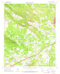
1961 Map of Alexander
USGS Topo · Published 1966About this map
Ellis Mountain and Alexander Mountain dominate the topography of this central Arkansas survey, where the rugged terrain begins to level toward the coastal plain. The Missouri Pacific railroad serves as a primary corridor, connecting the settlements of Alexander and Mabelvale along the southern edge of the sheet. The landscape is a mix of small communities like Martindale and Collegeville interspersed with institutional sites and recreational spaces, including the State Girls Training School and Aldersgate Camp.
Find a feature on this map
59 named features on this map. Tap any name to fly to it.
Don’t see what you’re looking for? This feature index may not catch every label — zoom into the map to look around manually.
Map Details
Editions of this 1961 Alexander Map
4 editions found
Other maps of this area

1890 · Benton
USGS Topo · 1:125,000

1891 · Little Rock
USGS Topo · 1:125,000

1893 · Little Rock
USGS Topo · 1:125,000

1894 · Benton
USGS Topo · 1:125,000

1935 · Little Rock
USGS Topo · 1:24,000

1935 · North Little Rock
USGS Topo · 1:24,000

1935 · Alexander
USGS Topo · 1:48,000

1938 · Benton
USGS Topo · 1:48,000

1941 · Alexander
USGS Topo · 1:62,500

1943 · Pinnacle Mtn
USGS Topo · 1:31,680