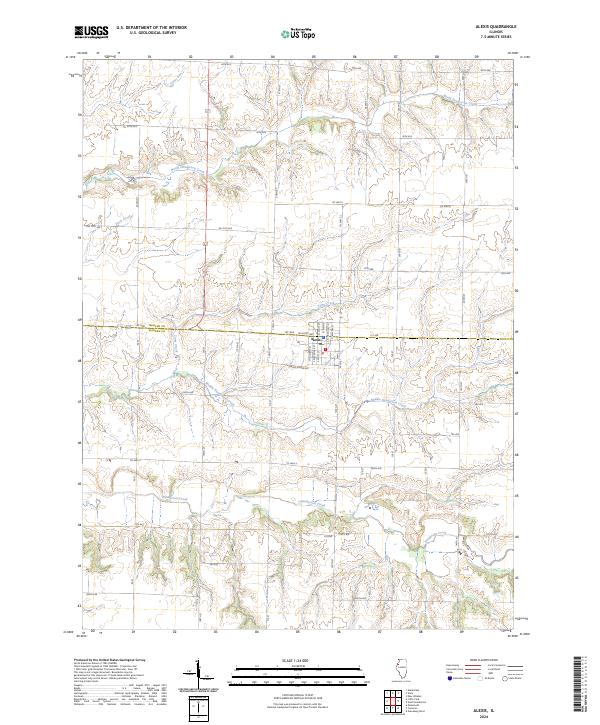
2024 Map of Alexis
USGS Topo · Published 2024About this map
Alexis sits at the junction of Mercer and Warren counties, serving as a central hub for the surrounding agricultural prairie. The village is organized around a traditional grid of streets, including W Hunt Ave and Spring Grove Ave, with the northern border defined by 1st Ave. This 2024 survey illustrates a landscape deeply etched by an intricate drainage system that flows generally westward toward the Mississippi River valley. The hydrology of the region is dominated by the three branches of the Henderson system: North Henderson Creek, Middle Henderson Creek, and Henderson Creek itself. These waterways, along with smaller tributaries like Toms Creek and Goose Run, create a pattern of undulating terrain that breaks the regularity of the surrounding section-line roads such as 40th Ave and Co Hwy 4.
Find a feature on this map
25 named features on this map. Tap any name to fly to it.
Don’t see what you’re looking for? This feature index may not catch every label — zoom into the map to look around manually.
Map Details
Editions of this 2024 Alexis Map
This is the sole edition of this map. No revisions or reprints were ever made.
Other maps of this area

1921 · Monmouth
USGS Topo · 1:62,500

1923 · Monmouth
USGS Topo · 1:62,500

1923 · Alexis
USGS Topo · 1:62,500

1925 · Alexis
USGS Topo · 1:62,500

1925 · Galesburg
USGS Topo · 1:62,500

1927 · Galesburg
USGS Topo · 1:62,500

1947 · Woodhull
USGS Topo · 1:62,500

1953 · Viola
USGS Topo · 1:24,000
1953 · New Windsor
USGS Topo · 1:24,000
1953 · Aledo East
USGS Topo · 1:24,000