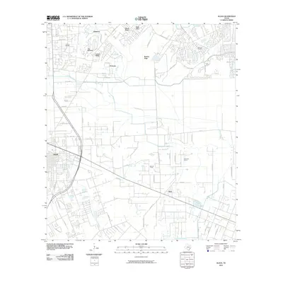
2010 Map of Algoa
USGS Topo · Published 2010About this map
Dickinson Bayou and Mustang Bayou wind through this coastal prairie landscape, illustrating the suburban transition of northern Galveston County and parts of Brazoria County. The small community of Algoa sits at the junction of several rural routes including Mustang Rd and Algoa-Friendswood Rd, while the eastern edge of Alvin shows significant residential development. The area's economic history is rooted in resource extraction and transportation, evidenced by the Hastings Oil Field and the Algoa Oil Field. Local navigation is defined by a mix of natural waterways and man-made infrastructure like the American Canal. Other prominent landmarks include the Kami-Kazi Airport and the Magnolia Cemetery, which provide points of interest for genealogists and local historians tracking the growth of nearby Windsong and El Dorado at the start of the 21st century.
Find a feature on this map
62 named features on this map. Tap any name to fly to it.
Don’t see what you’re looking for? This feature index may not catch every label — zoom into the map to look around manually.
Map Details
Editions of this 2010 Algoa Map
This is the sole edition of this map. No revisions or reprints were ever made.
Other maps of this area

1916 · Genoa
USGS Topo · 1:24,000

1916 · Seabrook
USGS Topo · 1:24,000

1920 · Seabrook
USGS Topo · 1:31,680

1920 · Genoa
USGS Topo · 1:31,680

1920 · Mykawa
USGS Topo · 1:31,680

1929 · Dickinson
USGS Topo · 1:24,000

1929 · Algoa
USGS Topo · 1:24,000

1929 · Hitchcock
USGS Topo · 1:24,000

1932 · Algoa
USGS Topo · 1:31,680
1932 · Genoa
USGS Topo · 1:31,680